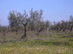
Turning olives and vines into energy
Geographic Information Systems (GIS) have been used to shed light on a variety of multidisciplinary scientific problems. The ability of GIS to incorporate, analyse and present different types of spatial data from a variety of sources makes it a truly unique tool. The Energy, Environment and Sustainable Development Programme funded a project entitled ECHAINE that sought to apply GIS techniques to the issue of wood energy supply chains in Europe. The Escola Superior Agrária de Beja examined the situation in its home country of Portugal. The Portugese researchers constructed a GIS database using all available data sources (e.g. military maps, land-use maps, etc.). An investigation into the various types and amounts of biomass (e.g. olive tree and vine cuttings) produced in each county in southern Portugal was also performed. The Escola Superior Agrária de Beja found that of the nearly one million tonnes of dry biomass produced in the region annually, just a small fraction is actually exploited for energy production purposes, mainly as firewood. They estimated that several thousand terrajoules (TJ) of energy could be gained from cuttings and residues that could be effectively distributed to users in the region. While the GIS tools proved extremely valuable during the course of ECHAINE, the issues of data quality and availability as well as the cost of software licenses could be limiting factors. The results of the research have been made available to the research community via publications in peer-reviewed journals as well as through ECHAINE workshops and the project website.


