Rescue remedy for water resources in Egypt
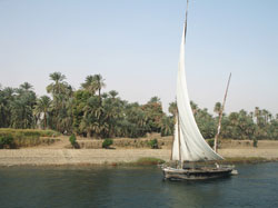
At Abu Qir, a small fishing town, one can sunbathe on the beach, fish, swim and eat fresh seafood. Abu Qir is also the home of many historical sites dating from the Egyptian, Greek and Roman dynasties. At El Tabya Pump station, about two million cubic metres of industrial waste water is pumped every day into Abu Qir Bay. Needless to say, these two features serve to epitomise the potential and the problems of the region. Widespread development of the Mediterranean coasts generally provided the catalyst for the EC funded project SMART to explore methods for long-term sustainable resource management policy. The statistics collected and subsequent recommendations can then be utilised to manage and balance resources between the coastal and inland areas. Project partners at the Centre for Environment and Development for the Arab Region and Europe, CEDARE in Cairo chose to concentrate specifically on the often-polluted water resources in the area of the Abu Qir Bay region. The whole area includes not only the bay itself but the Rosetta branch of the River Nile, Lake Edku and is bounded on the south side by the Mahmoudia Canal. The ancient city of Alexandria with its approximately four million inhabitants relies on its freshwater supply from the canal which emanates from the Rosetta branch of the Nile. Development, a lot of which is unplanned, is industrial, agricultural and domestic in its source. With its fertile plains that form valuable productive land and the host of archaeological sites, the region is considered to have a wealth of undeveloped potential. However, lack of planning, awareness and sustainable management strategies have rendered a situation where the environment is damaged and degraded. The team at the centre used state-of-the-art technologically advanced tools to study all aspects of the area. These included remote sensing, geographic information systems (GIS) and water resource modelling including both quantitative and qualitative measurements. These were used to formulate an integrated plan for sustainable development that includes all aspects of water supply limitation and its causes. These range from inadequate infrastructure to lack of awareness of involved parties in industry, government and the public at large. Implementaiton of the findings of this report may well contribute to halt the rapid decline of the water quality in the area. Stemming the pollution and cleaning up the resource can then lead to increased development of the area. Interested parties can access the project website at http://www.ess.co.at/SMART/ for further information.


