Decision support system uses satellite data to predict and manage fires
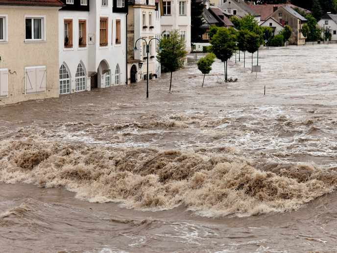
Due to global warming, wildfires are getting worse. Fire seasons are lengthening, and when fires occur, they are hotter, more frequent and faster spreading than ever. This causes huge environmental and economic damage. Long-range forecasts indicate a worsening trend. According to the EU’s Forest Strategy 3, firefighters and management agencies must switch from an immediate-response focus to long-term planning for prevention. However, doing so requires an ability to predict fire occurrence, behaviour and long-term trends. Unfortunately, European agencies currently lack this ability. Data from various sources are poorly integrated. Furthermore, fire ignition is detected too slowly, and current fire management tools are inadequate.
Decision support
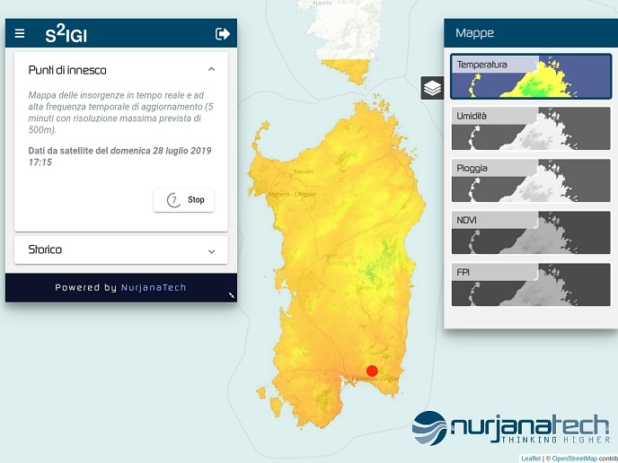
The EU-funded S2IGI project developed a software decision support system (DSS) to assist with fire management. The project’s name derives from the Italian phrase Sistema Satellitare Integrato Gestione Incendi, meaning integrated satellite system for forest fires management. The project developed the DSS, which draws upon the expertise of project partners. The system has initially been set up to manage wildfires in Sardinia, but it will be applicable worldwide. The DSS operates in the whole process of fire management subdivided in three main phases: the strategic phase, meaning forest fire prevention and mitigation; tactical firefighting phase; and the post-event phase, which is recovery. “Fuel and probability index maps support the strategic phase,” explains project coordinator Maurizio Cao; “hotspot and flame-front maps – integrated with weather and terrain data – support the tactical phase; and the final phase is supported via burnt-area maps.”
Satellite images
Such maps combine several kinds of high-resolution satellite data to generate vegetation cover and fuel load indices. These, combined with weather and ground type data, yield a fire probability index. Special algorithms use a combination of visible light and infrared satellite data to track hotspots and fire front movement. The algorithm is currently accurate to 4 degrees, but with new versions incorporating machine learning, it will eventually be accurate to 0.5 degrees. The system again uses satellite data to compare before- and after-fire vegetation coverage, to map affected areas. The DSS combines all relevant variables, which can change minute by minute during a fire, to provide a decision-making process based on priorities and evaluation of risk factors. The system suggests the optimal way to deploy resources for firefighting, based on immediate conditions. “With the current version of the algorithm, we have achieved a detection performance of 90 % for large wildfires with a false-positive probability of 5 %.” He adds that the real advantage of the S2IGI system is that large areas can be automatically monitored from space, without field deployment of resources. The system constantly updates every 5 minutes. The project’s next step will be to market the system to fire management agencies and insurance companies in Spain, Italy and Portugal. In addition, the team will be seeking Phase 2 EU funding to refine both the product and the commercialisation process. S2IGI’s system will permit more effective fire management with fewer resources. This will mean more forest, property and lives saved.
Keywords
S2IGI, satellite data, fire management, wildfire, algorithm, decision support system, forest fire, vegetation cover, Forest Strategy