Saving the lagoons of southern Europe
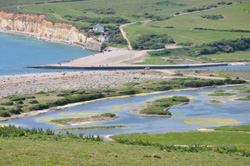
Aquaculture, shipping and other human activities have resulted in serious environmental degradation of these valuable natural resources. The EESD Programme funded a collaborative research effort dedicated to exploiting information technology to improve the outlook for these lagoons. The National Institute of Fisheries and Sea Research led an investigation of Ria Formosa, a lagoon located in the Algarve region of southern Portugal. Relevant water, soil, biological and climatological data was collected into a single database. A Geographic information system (GIS) tool was used to display the data as well as results from a number of computer models. One of the models applied, the Soil and water assessment tool (SWAT), simulated hydrodynamic and biogeochemical parameters on daily, monthly and annual timescales for the entire watershed. In addition, an Ecological dynamics model (EcoDynamo) provided the opportunity to assess the impact of various policy options. This step was facilitated by special meetings between DITTY participants, stakeholders and local authorities. A key aspect of the approach was the proper inclusion of the financial aspects of the various initiatives. The interaction between internal and external factors was addressed via a Strengths, weaknesses, opportunities, and threats (SWOT) analysis. Several useful recommendations evolved from the SWOT analysis concerning bivalve aquaculture and channel geometry. A final tool developed during DITTY was a Decision support system (DSS) that incorporated both environmental and economic constraints. The DSS was made available to the Ria Formosa Natural Park, the entity responsible for the management of the lagoon. Workshops were held to disseminate the findings and tools to local authorities and stakeholders. In addition, a Portuguese coastal lagoon network (PLANET) was established to encourage application of the tools to other lagoons throughout Portugal.


