Simulation models support flood forecasting
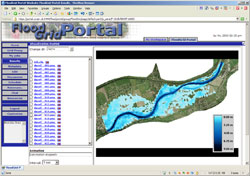
The CROSSGRID project has developed user-friendly grid components for interactive, data intensive applications such as simulation and visualisation. These can be used in case of a flood crisis and can also be combined with weather forecasting. The grid can be used in eleven European countries and is furnished with components which can monitor application performance, distribute data and manage resources. One such example is the flood forecasting application framework which can assist users. For example it can browse the results of simulations, register results into the replica management service and applicable metadata into the metadata catalogue for later search and retrieval. Moreover, the application consists of several simulation models including meteorological, hydrological and hydraulic which are connected to form a workflow. Thus, the meteorological model forecasts precipitation; the hydrological model computes this for river discharge and finally the hydraulics model uses that computation to determine possible flood. The binary output data each model produces are used to create pictures which can help evaluate the situation. The flood forecasting application has two user interfaces which assist in providing a more user-friendly interaction. One is applied as a web portal which can be accessed by standard web browser. The second is applied as a plug-in for Migrating Desktop (MD), an environment helping users work with the grids that have been developed.


