Easy monitoring of Earth’s biophysical indicators at multiple scales
Artificial satellites have multiplied exponentially, providing invaluable scientific data about the changing state of our planet. The EU-funded OEMC project is leveraging digitalisation, collaboration and open access to exploit these data with a FAIR-compliant scalable cyberinfrastructure. It assimilates the highest quality data and outputs and facilitates visualisations via a web-GIS app.
Co-development and open-source code for Earth monitoring
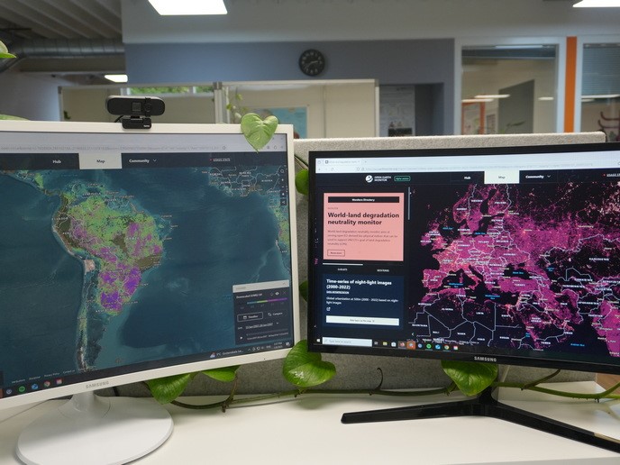
“OEMC embraces the use and extension of open-source software, open reproducible procedures and data sharing,” says project principal investigator Tom Hengl, director at OpenGeoHub Foundation. It builds on several existing platforms – most importantly openEO, OpenLandMap, Copernicus Data Space Ecosystem and data from the European Environmental Agency. Users can improve existing data and services and develop their own. Visualisations and dashboards will be made for users that they can quickly deploy and improve. In addition, the team has produced several new data sets. For example, land degradation hot spots can be identified from a monthly time series of global images from 2000 to 2022 as part of OEM’s land degradation neutrality monitor supporting the United Nations’ Convention to Combat Desertification. Five-metre resolution images resulting from data fusion of Sentinel and Norway’s International Climate and Forests Initiative (NICFI) data were used to map drivers of deforestation across Africa. OEMC also developed a computational framework employed to produce cloud-free, bi-monthly aggregated, global Landsat composites for 1997–2022 at 30-metre resolution with applications including land cover analysis and crop-type mapping. “All code is publicly available on GitHub allowing anyone to extend and improve it,” Hengl says.
Pilot use cases at global, European and national scales
OEMC currently has more than 20 monitors such as the ‘World drought monitor’, ‘EU biodiversity monitor’ and ‘Tropical deforestation monitor’ (Ethiopia). They cover global, European and national scales. Each monitor has a designated leader and at least one stakeholder organisation, including political organisations, NGOs and SMEs. “Users are at the centre of monitors’ design, and applications are often developed in close collaboration,” Hengl notes. The monitors have one or more associated datasets and one or more geostories (pilot use cases), some relying on the integration of two or more monitors. So far, there are 30 geostories for the over 20 monitors, and the number is growing. For example, the ‘Air quality during COVID-19 (Europe)’ geostory utilises the ‘EU-air quality monitor’. The project runs until May 2026. The team is currently uploading use cases to the GEO’s Knowledge Hub. About 80 % of the project’s outputs will be released in 2025 and widely promoted at the European Geosciences Union General Assembly, the Living Planet Symposium, the Group on Earth Observations Global Forum and OEMC’s global workshop in Belgrade.
Putting Earth monitoring tools in citizens’ hands
“The ultimate goal of OEMC is to produce tools that can be seamlessly used by citizens regardless of their technical or scientific backgrounds,” emphasises Hengl. Users can quickly and easily find a monitor and associated use case through the Map tab of the web-GIS app and access and download the data from Zenodo. Hengl adds: “Modern open-source solutions for analysis and visualisation of geospatial data can be used for decision making to save human lives or to enable everyone’s access regardless of their budget. Thanks to cloud-optimised solutions for geospatial data such as cloud-optimised GeoTiff and Zarr, you can analyse whole-world data on your laptop!” The platform accelerates the uptake and use of environmental information by policy makers and scientists, and ultimately every citizen, building European and global communities inspired by common goals.
Keywords
OEMC, Earth monitoring, Copernicus, deforestation, land degradation neutrality, open-source software, biodiversity, drought