Throwing a wider net to close gaps in civilian maritime surveillance
A plethora of commercial monitoring systems for terrestrial and marine environments and assets are now available. However, integration into coast guards’ tasks of maritime surveillance operations to address migrant smuggling, drug trafficking and other concerns is suboptimal. For example, the unmanned aerial vehicle (UAV) industry is well-developed and increasingly used on land. Nevertheless, affordable systems are not designed to operate at sea and more expensive systems used by some individual ships are not integrated into a large-area surveillance network. The EU-funded COMPASS2020 project brought together 16 partners from nine countries to address this critical challenge. The project’s solutions enable not an evolution but a step change – with AI-supported, coordinated, long-range and persistent civilian maritime surveillance twenty-four hours a day at maximum resolution.
Integrating manned and unmanned surveillance platforms
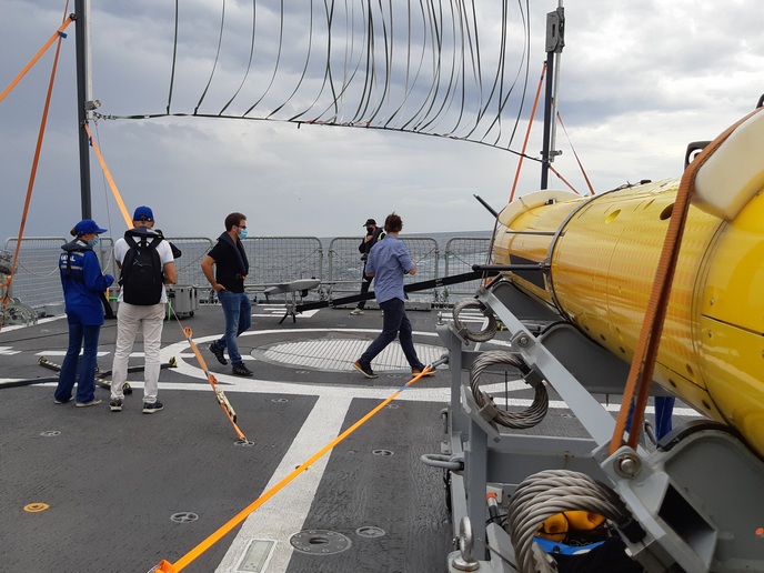
COMPASS2020 laid the foundation for a ‘system of systems’ by demonstrating the ability of existing offshore patrol vessels (OPVs) to autonomously launch and operate UAVs and autonomous underwater vehicles (AUVs). The UAVs and AUVs significantly enhance OPVs’ surveillance range and the types of data available to them. The OPVs can also receive data from long-endurance UAVs deployed from shore. According to project coordinator João Piedade of the Portuguese Navy: “the UAV TEKEVER AR3 is easily deployed by an OPV. It can augment the surveillance capabilities of the vessel tenfold.” COMPASS2020 demonstrated this capability — and this was just the beginning.
Coordinating multiple OPVs via a central command centre
“If an OPV is not working alone but integrated in a wider surveillance system using all the data from the network, the area that can be monitored is enormous,” adds Piedade. COMPASS2020 made this possible with its ‘system of systems’ leveraging data fusion and sharing to connect many OPVs in real time. Its ‘agnostic integrator’, deployed onboard the OPV and at an onshore maritime command centre, can receive data from different maritime assets, no matter the provider or operational environment (air, surface or subsurface). It integrates real-time data streams from UAVs, AUVs and conventional monitoring systems (radar and automatic identification systems) to enhance situational maritime awareness. For example, a radar system can detect a target but, when augmented with AI, can provide indications of anomalous behaviours in addition to location, direction and speed. A UAV enhanced with image recognition systems can provide vessel classification information (for example, a fishing vessel, speed boat or merchant vessel) and the number of visible occupants. The maritime command centre not only receives data from the OPVs but transmits it to them. Leveraging data fusion and AI, it can plan and optimise the deployment of combined maritime assets according to threats and risks, simultaneously coordinating the activity of several OPVs.
Closing gaps — literally and figuratively — in maritime surveillance
“The project was very challenging. We’ve integrated many systems, including the AIRBUS system that enables automated take-off and landing of a UAV from a moving OPV. Most importantly, COMPASS2020 demonstrated that data from different available aerial and underwater systems can be integrated to form a wide-area, persistent maritime surveillance network,” concludes Piedade. Piedade underscores the invaluable collaboration between end users and industrial and scientific partners, who worked together to demonstrate the solutions in real life scenarios. COMPASS2020 solutions expand surveillance coverage and enhance temporal and spatial resolution. The greater reliability and availability of data and the AI-backed coordination of maritime assets will lead to greater maritime safety and security cost-effectively.
Keywords
COMPASS2020, maritime, OPV, UAV, maritime surveillance, AI, AUV, data fusion, offshore patrol vessels, autonomous underwater vehicles, migrant smuggling, coast guard


