The vast collective effort to track change across the Arctic
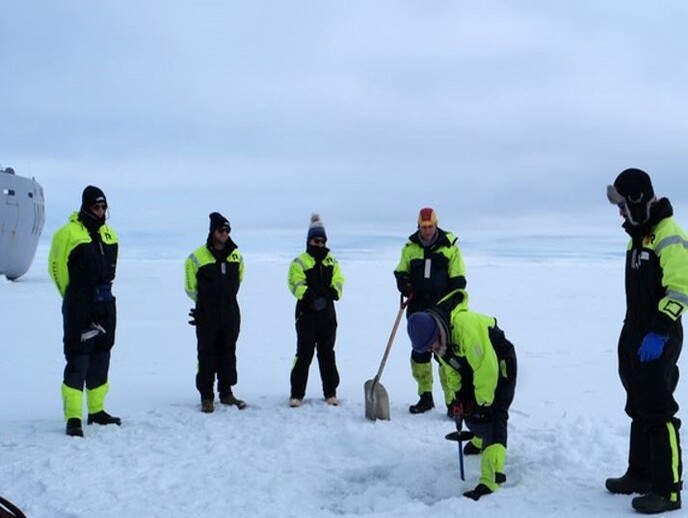
The world took note when rain fell on Greenland’s icy summit this summer for the first time since records began in 1950. With climate ‘firsts’ now a regular occurrence, data enabling us to track and analyse these changes is becoming a vital resource for humanity. This is particularly significant in the Arctic, where the climate crisis is already triggering deep changes with global impact such as rising sea levels and changing weather patterns. To fill in the gaps and make better use of available data, the EU-funded INTAROS (Integrated Arctic observation system) project is working to develop an integrated Arctic observation system for atmosphere, ocean and terrestrial science. Their research focuses on local observation, which complements satellite monitoring of the environment by delivering the physical and empirical evidence required to check, refine and interpret remote sensing data. Project coordinator Stein Sandven explains: “Sea ice decline in the Arctic has been documented through satellite observation for over 40 years. By providing in situ measurements of aspects such as temperature, salinity and thickness, we help to create better algorithms and contribute to making more reliable predictions about future decline.”
Data for daily life
His team from the Nansen Environmental and Remote Sensing Center (NERSC) worked with partners to create an inventory of existing observation systems and data. These include projects from across the globe, and also local communities in the Arctic who monitor the natural resources they need for their livelihoods. “For instance, fishermen in Greenland record information on catches in a database. Data on increasing or decreasing fish stocks is then shared with local government to determine fishing quotas,” Sandven says. This is a two-way process: while the information collected by local communities feeds into the new integrated system, the project is also making additional data available for their use.
More dots to connect
One of INTAROS’ key achievements is the development of new solutions filling important gaps in the existing observation systems. A network of drifting buoys was deployed across the central Arctic to collect data about sea ice such as temperature, air pressure and thickness, which is then transmitted via satellite. The team uses bottom-anchored moorings to collect oceanographic, acoustic, biological and geochemical data under the sea ice. As the data cannot be transmitted under the sea, the moorings are collected after 1 or 2 years in operation. Other examples include automated instruments installed on ships travelling across the Arctic, and automated stations collecting atmosphere and cryosphere data on the Greenland ice sheet. “Deploying additional instruments in the Arctic is important: the Greenland ice sheet alone covers an area of over 1.7 million sq. km,” Sandven notes. “You need to have a certain network of stations to collect enough data.”
Online access
All data collected is made available free of charge through the project’s iAOS web portal for a variety of uses. Target audiences include local communities, national agencies, climate researchers and data scientists. The EU’s large Earth observation programme Copernicus currently faces a considerable in situ data deficit in the Arctic. Increasing the amount of data made available through INTAROS – by ensuring its regular distribution in standard formats – will turn the project’s database into a key resource for a number of Copernicus services.
Keywords
INTAROS, Arctic, climate change, in situ, Earth observation, remote sensing, data, Greenland, sea ice


