Geological and geophysical investigations on Mars’s sub-surface ready to reveal tantalising clues about rocky planet formation
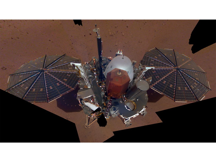
In November 2018, the InSight lander screamed through the Martian atmosphere and set down safely on a flat smooth expanse of lava called Elysium Planitia. The mission seeks to uncover how a rocky body forms and evolves to become a planet by investigating the interior structure and composition of the Red Planet. Previous missions to Mars have investigated the surface history by examining features such as canyons, volcanoes, rocks and soil. So far, little has been known about what’s going on a couple of kilometres below the surface. “Mars's interior structure bears the record of how the planet evolved differently from Earth over time. This information can also be used to predict the composition of rocky exoplanets that are believed to have Mars-like internal properties,” points out Lu Pan, coordinator of the EU-funded GeoInSight research project undertaken with the support of the Marie Skłodowska-Curie programme.
Insight into the Red Planet’s inner workings
Mars's new robotic resident is the first robotic explorer using cutting-edge instruments that delve deep beneath its surface for detailed studies of the planet’s interior. So far, the supersensitive seismometer suite has detected many vibration events, more than 300 of which are confirmed ‘marsquakes’ of up to magnitude 3-4 based on a scale developed by Mars seismologists. Seismic waves produced by a quake move like rays of light – they get trapped, reflected and refracted in different directions. Different materials interact with the waves in different ways, resulting in complicated waveforms. “Using spectroscopy data on the Martian surface helps determine the type and composition of rocks and estimate how deep the rocks lie beneath the lander. This information could potentially explain some characteristics of the seismic waveforms recorded by InSight’s seismometer,” explains Pan. The GeoInSight researchers believe that the first few kilometres of the crust are likely to host structurally complex regions. They found crust structures made up of interbedded sedimentary deposits beneath the lava flows close to the landing site. “These heterogeneities in the Martian crust may create a low-velocity zone or increase the scattering of the seismic waves, alter the seismic waveforms and complicate the interpretation of the seismic data collected by the lander’s instrument,” adds Pan. While scientists are thrilled about the detected motions underground, they wish the marsquakes were stronger. Over the course of the mission, they expect to record many more, some as powerful as 5 or 6 in magnitude that would provide plenty of energy for revealing details of Mars’ mysterious core.
Spectral signatures of the landing site
Spectroscopy has played a crucial role in Mars exploration missions, including confirmation of the presence of various hydrated minerals on the Martian surface. As in this expedition, the GeoInSight researchers used the Compact Reconnaissance Imaging Spectrometer for Mars – a visible-infrared spectrometer aboard a satellite that has been orbiting the planet since 2006. Analysis of the orbital spectral data on more than 90 shortwave-infrared spectral images, and further processes to reduce noise and artefacts, helped researchers reveal more about the type of minerals and rocks on the Mars's surface. Insight’s mission cannot be regarded as only a Mars mission, but rather an entire solar system mission. GeoInSight’s reported findings and future geophysical data will help reveal clues about rocky planet formation, especially why Venus, Earth and Mars had different fates in the course of planetary evolution.
Keywords
GeoInSight, Mars, Insight, lander, rocky planet, Earth, seismometer, marsquakes, exoplanet


