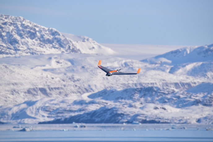
Improved unmanned aerial vehicles for better marine management
Europe’s vast coasts and economic areas that stretch far into the Atlantic and Arctic oceans are challenging to monitor and manage. Large research vessels, buoys, satellites and manned aircraft are usually deployed for this purpose, which as well as providing limited coverage, also come at high financial costs. The oceans and coasts are therefore relatively under-sampled and there is a dearth of data with the required information about space, time and features. Autonomous unmanned aerial vehicle (UAV) systems are being increasingly used as a solution. They offer high endurance, reduced cost, flexibility, rapid deployment and higher accuracy/resolution, with reduced risk for humans and the environment. But exploiting the technology is complex and requires inter-disciplinary knowledge involving extensive field testing and airworthiness certification to meet the standards set by aviation authorities. To help facilitate this, the EU-funded project MarineUAS (Autonomous Unmanned Aerial Systems for Marine and Coastal Monitoring) trained 16 early stage researchers across several countries, forging a collaborative environment which benefited from the partners’ extensive knowledge, field experience and facilities to improve the technologies.
More eyes in the sky
The deployment of UAVs is intended to augment the capabilities of research vessels, providing scientists and government agencies with significantly more ‘eyes in the sky’. The design of the UAVs varies, ranging from multi-rotor machines with hovering and vertical-take-off-and-landing (VTOL) capabilities, to fixed-wing UAVs with long range, high endurance and speed. The researchers were placed in leading European research groups where they had access to the necessary software and experimental facilities to develop and test new theories and technologies. “No single nation has the full research competence required to adequately prepare Europe’s researchers for these demanding tasks, which is why the consortium partners were so valuable,” says Prof. Tor Arne Johansen from the Department of Engineering Cybernetics at the Norwegian University of Science and Technology (NTNU). The researchers built and experimentally tested prototypes to improve wind measurement and smart processing, as well as methods for the safe landing of fixed-wing UAVs on small ships, and the UAVs’ ability to withstand harsh weather conditions. Other characteristics, such as collision-avoidance enabling more efficient use of shared airspace, were tested in simulation. Furthermore, the UAVs were given higher degrees of autonomy and intelligence, with some specially adapted to give them the ability to work in tandem with unmanned surface and underwater vehicles, for example for the exchanging of data.
Future-proofing marine management
The protection and sustainable management of marine resources is an important policy aim for the EU, as outlined in its Strategy for Marine and Maritime Research. “MarineUAS’s results contribute in a number of ways, such as increasing the capacity and efficiency of maritime search and rescue, especially in the Arctic. Likewise, these technologies which monitor the environment, fisheries and borders for effective management of marine protected areas, also benefit climate science more widely, as they provide key indicators of climate changes,” says Prof. Johansen. Currently, the project’s industrial partners have plans to use the technologies developed for unmanned air traffic management (UTM), inspection of coastal and maritime infrastructure, and with the deployment of all-weather UAVs that can operate from ships. This research was undertaken with the support of the Marie Skłodowska-Curie programme.
Keywords
MarineUAS, unmanned aerial vehicle, marine monitoring, protected area, climate change, fisheries, Arctic, oceans, coasts, environment, underwater


