Observing wetlands from above
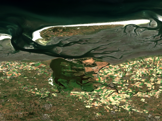
Wetlands play a central role in water cycle and climate regulation and offer various economic benefits through their services (leisure, tourism, etc). However, anthropogenic activities such as the increased land conversion to urban and agriculture areas as well as pollution, threaten the balance of wetland ecosystems. Policies aiming at the conservation and management of wetlands are difficult to implement due to lack of knowledge. To improve integration of wetlands in European policies, Member States in Europe have committed to the mapping and assessment of ecosystem services. The EU-funded SWOS project was designed to provide information on wetland ecosystems using data from the Sentinel satellites. SWOS was a unique partnership among user organisations, academia and industry with expertise in the development of innovative methodologies for wetland conservation. As project coordinator, Kathrin Weise explains, “SWOS aims to provide a user-friendly wetland monitoring and information service that was developed for users by users.″ Ecosystem monitoring tools For wetland monitoring, SWOS has developed services including maps and indicators, a software toolbox and a community portal. A total of nine indicators such as land use, land cover, water quality and surface temperature were generated alongside maps to monitor their shifts over time and space. The methodology for assessing the capacity of wetland ecosystems to deliver flood regulation services is a prime example of how indicators can be used to understand the causes of various phenomena such as floods. According to Weise: “through the software toolbox GEOclassifier, specifically tailored for wetland mapping, monitoring and reporting, users have the ability to process satellite images and map specific indicators.″ Comparison of current observations with historical information, using satellite data from as far back as 1972, allows the assessment of biodiversity and the monitoring of dynamic changes in specific wetlands over time. Following user demand, this indicator mapping approach has been applied in specific cases to obtain information on 50 wetland sites in Europe, Africa and the Middle East. These cases demonstrated how satellite-derived information can be integrated to facilitate wetland management. Collectively, all this information on wetlands is collected in the GEO-Wetlands portal, an easy-to-access entry point that combines SWOS data and external databases. It also portrays wetland condition and its capacity to provide services through geospatial data, indicators and statistics. The impact of implementing SWOS services SWOS products and services will be useful to those with a need to monitor natural resources remotely and provide data for the management of wetlands. Such users include non-governmental organisations, research institutions and natural resource agencies. By considering the hydrological and ecological characteristics of a wetland, SWOS allows for an integrated assessment of the ecosystem and its threats. It also provides the big picture on the status of the world’s wetlands. Application of the SWOS approach for mapping wetland ecosystems in Greece has enabled local authorities to understand the changes in wetland extent due to for example conversion to agriculture. In Tanzania, trends in land use have helped wetland managers to develop strategies that support both economic development and sustainability of natural resources. Overall, SWOS deliverables provide a unique satellite-based approach for wetland monitoring and assessment of services. In view of the future, Weise is confident that “with appropriate training, the SWOS legacy will reverse the process of declining wetlands.″
Keywords
SWOS, wetland, ecosystem, indicator, satellite


