Earth observation aids water management
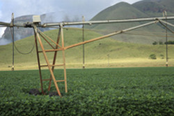
In non-industrialised countries, a lack of water for farming can cause conflicts that destabilise entire regions, both economically and socially. Periodic droughts and floods, as well as growing populations, exacerbate the problem. The EU-funded SIRIUS project drew on satellite imagery and other data and media to create tools that help communities manage water resources effectively. The tools include maps of irrigation water requirements and crop water consumption, as well as integrated river basin and drought management advice to facilitate sustainable agriculture. All three SIRIUS services (drought, irrigation and farm management tools) are powered by an easy-to-use online system known as SPIDER. This platform encourages stakeholder participation, collaboration, and transparent governance due to its non-academic and non-technical interface. The services have been piloted in water-scarce regions in Brazil, Egypt, India, Italy, Mexico, Romania, Spain and Turkey, during at least one growing season. In parallel, researchers assessed key aspects of sustainable water management within these regions. Furthermore, SIRIUS developed a roadmap for ongoing implementation of the services in all of the pilot areas. Ultimately, these new tools will help reduce conflict caused by water shortages.
Keywords
Earth observation, water resource management, food production, farming, satellite imagery, irrigation water, crop water, river basin, drought management, agriculture, SPIDER, water shortage


