New sensor technology to enable future space exploration missions and on-orbit satellite servicing
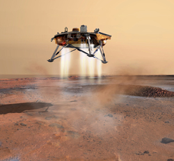
Future planned missions that entail putting people on the Moon or Mars will require sub-kilometre (km) precision for entry, descent and landing (EDL). Currently, landing accuracies are about 1 km on the Moon and a whopping 10 kms for Mars. Other missions type will focus on precise in-orbit rendezvous with collaborative or no-collaborative targets. The EU-funded project 'Flash optical sensor for terrain relative robotic navigation' (FOSTERNAV) is developing the sensor technology that will enable future missions requiring increased relative navigation precision. The Flash imaging LiDAR technology is based on modified state-of-the-art laser rangefinder (light detection and ranging, or LiDAR) technology. It enables the capture in real-time of 3D snapshots of an area-of-interest using time-of-flight (TOF) detector array. Such arrays form the keystone of touch-free interfaces in gaming applications that are being modified by FOSTERNAV researchers for space navigation using advanced optical remote sensing. Following the design of the flash imaging LiDAR device as well as design and preparation of the test facilities and testing protocols, the manufacturing and evaluation of the sensor building blocks are now underway. FOSTERNAV expects to deliver an optical laser sensor combining ranging and imaging functions in a compact, autonomous hardware and software solution that should meet future space mission requirements. As the world looks toward the Moon, Mars and beyond, the project's technology ensuring precise and safe EDL and in-orbit rendezvous will put the EU in a highly competitive position for the future space market. This technology has also a great potential for terrestrial applications such as the safe and autonomous operation of vehicles.


