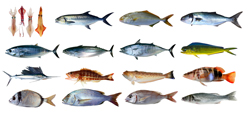
A new, more comprehensive European Fish Index
The number and variety of fish, known as a fish assemblage, is a common measure of the health of a particular lake, river or other body of water. Nature is, however, much more complex. For this reason, the ‘Improvement and spatial extension of the European fish index’ (EFI+) project looked to build upon previous research to develop an indicator applicable across a wide range of regions and ecosystems. The first step involved identifying and resolving problems with the current European Fish Index (EFI). For example, the initial formulation of the EFI was based on data collected primarily in northern Europe. It was therefore necessary to expand the database with studies from southern Europe, in particular the Mediterranean. During the project, an attempt was also made to incorporate variables relevant to large floodplains since this aspect had previously not been taken into account. Furthermore, the new EFI integrates output from statistical models that simulate the negative impact of human pressure on these highly sensitive ecosystems. In the end, two alternative EFIs were designed, each representing an average of several different parameters. Software was developed and made available online free of charge to assist researchers and decision makers alike calculating the new EFIs. Feedback following initial trials with the EFIs was positive. Not only can the step of calibration be avoided, but more accurate comparisons between regions and countries are now possible. Use of the new EFIs will help Europe map the status of its vast and varied water resources in line with the WFD and consequently contribute to improving wildlife management.


