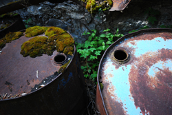
Software for seabed toxic waste
Effective management of toxic waste buried in the seafloor demands that it be properly mapped and the potential environmental impact correctly assessed. A lack of reliable information can result in serious consequences for marine life and human activities, such as fishing. Conventional methods have proved ineffective at determining the location and size of dumped containers buried under sediment. The use of new techniques can enable both known and suspected dumpsites to be effectively investigated in a cost-effective way. The SITAR project developed 3D acoustic imaging methods for examining the contents of toxic dumpsites, including small containers deposited within the seabed. The consortium produced and tested 'Geographical information system' (GIS) and software tools for handling environmental, biotoxicological and geographic field data. The information is displayed according to the user's specifications and measurements can be compared according to time and space. Instrumentation developed by the SITAR consortium was first tested under carefully controlled conditions at a known toxic waste site in the Baltic Sea. The system was evaluated and verified by end-users who were able to study the distribution of containers around a dumpsite. Information provided by the equipment produced by the SITAR project will help decision-makers to manage seabed dumping sites effectively. Improved management of sites will enable Europe's marine environment and human population to be better protected from toxic waste.


