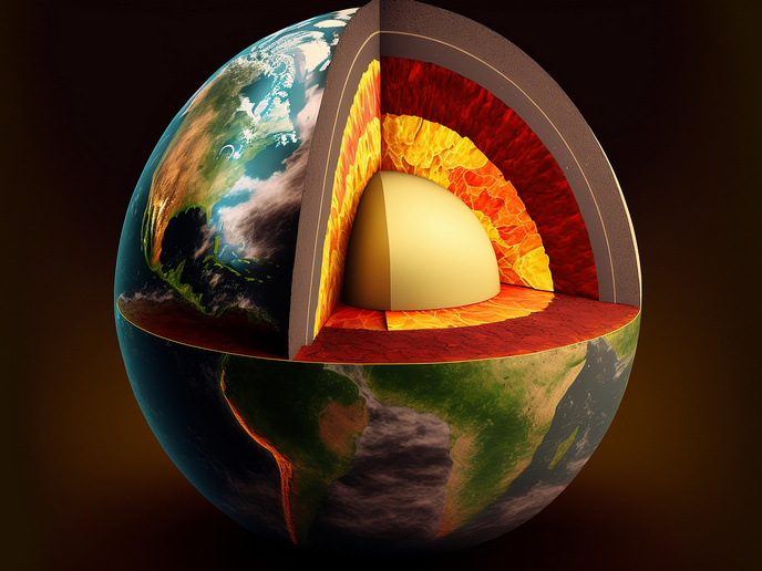
Innovative modelling offers a clearer peek into the Earth’s interior
Natural hazards – such as earthquakes, volcanic eruptions, long-term climate changes and ore-deposit formation – are directly influenced by processes occurring tens or even hundreds of kilometres below the Earth’s surface. However, due to the immense depths and extreme conditions involved, knowledge about the Earth’s interior has typically been acquired indirectly, principally from seismology – the study of earthquakes and seismic waves. But the resulting measurements can be misleading, as Manuele Faccenda from the University of Padua explains: “Tomographic images are contaminated by artefacts that get mistaken for real heat and compositional anomalies, leading to misleading interpretations.” Using geodynamic and seismological modelling techniques, the NEWTON project, which was funded by the European Research Council, developed and validated novel seismic imaging to better understand the Earth’s internal structure and dynamics. Complemented by advanced geodynamic simulations, the methodology was applied to the Mediterranean and Cascadia convergent margins, shedding further light on their complex subsurface structure and tectonic evolution.
Improving seismological simulations
Tomography uses penetrating waves to build an image of a structure section by section. Many scientific fields benefit from this method, including geophysics which takes measurements from seismic waves to create images of the Earth’s interior. Standard seismic imaging, which uses seismic waves generated by naturally occurring earthquakes, is based on the assumption that the Earth’s interior is isotropic, that is with locally constant physical properties, regardless of the direction being sampled by seismic waves. Yet, in reality, seismic waves suggest anisotropy, where wave velocity varies depending on their direction of propagation, resulting in anisotropic areas of the Earth’s mantle being recorded as fast or slow, even without the presence of thermal or compositional anomalies. NEWTON set out to account for seismic anisotropy. Using an innovative inversion technique which converts seismic data into the physical properties of rock, the project’s 3D model captures seismic anisotropy related to the fabric of mantle rocks. Fabrics are microstructures formed during rock formation, or, according to Faccenda, more frequently its deformation. “Because we know that the structural fabrics of these mantle rocks are formed mainly by deformation processes, we can invert our seismic data to simulate the evolution of the rocks. This lets us clean up the artificial velocity anomalies for a more accurate view of the mantle,” explains Faccenda. Thanks to the high-quality seismic data available from the tectonic boundaries where the Mediterranean and Cascadia plates converge, NEWTON applied its methods here. “We found that while mantle structural fabrics and deformation are more widespread than previously thought, they are in fact consistent with geological observations about the region’s tectonic evolution. We were also able to show that several known but ambiguous velocity anomalies were in fact only artefacts,” notes Faccenda. The project’s research also helped settle a long-standing debate related to planetary dynamics and compositional evolution, finding that rock or mineral layering actually had little effect on the mantle’s mechanical (elastic and viscous) behaviour.
Wider applications in economically sensitive fields
Unlike most existing inversion techniques, NEWTON’s are available in the open-source software package ECOMAN and are applicable to any natural setting. For instance, NEWTON’s technique can also image complex 3D crustal structures, previously only possible along the vertical or horizontal plane, locating the faults and fractures and so helping optimise mining operations, as well as improve hazard detection. Indeed, the team is now using the techniques to study volcanic, oil and geothermal fields, which display intense time-dependent fracturing. “Our methodology could help effectively monitor geologically important sites, providing critical information about their continuously evolving deep structure,” concludes Faccenda.
Keywords
NEWTON, seismic, wave, earthquake, deformation, mantle, fabric, Earth’s interior, tomography, anisotropic, isotropic, volcanic eruption, hazard


