Boosting Europe’s ocean monitoring capabilities
Accurate ocean data is critical to understanding the Earth’s climate, and to making estimates of how it will change in the future. To this end, the international Argo programme, launched in 1999, established a network of floats, deployed across the world’s oceans. The network consists of thousands of autonomous instruments that spend almost all their life below the surface, at depths of up to 2 000 metres. Data on temperature, salinity and the chemical make-up of the sea is relayed to satellites, and then sent on to receiving stations onshore. “This data, which is freely and openly accessible, is delivered in real time for operational users, such as meteorological offices, and for climate change research and monitoring,” explains Euro-Argo RISE project manager Estérine Evrard, from Euro-Argo ERIC in France.
Better coverage and more precision
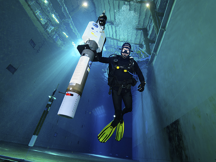
Euro-Argo ERIC coordinates Europe’s contribution to the programme and is responsible for operating around a quarter of the global Argo floats array. Around 2019, it was recognised that ocean coverage needed to be extended further into partially ice-covered polar regions and shallower waters, along with more biogeochemical sensors deployed and data management systems updated. These were some of the key objectives of the Euro-Argo RISE project, which also sought to bring Europe’s contribution into line with the programme’s long-term vision, called OneArgo. “To monitor climate change, we need long-term data,” says project coordinator Sylvie Pouliquen, also part of Euro-Argo ERIC. “This is why ensuring the sustainability of the Argo network is essential.” To achieve this goal, Euro-Argo RISE tested new sensors to assess their accuracy and performance, as well as floats’ capacity to survive in ice-covered areas. Ice-sensing software was used to ensure that instruments did not attempt to surface until they drifted into open sea. Similarly, float configurations were tuned for shallower waters and tested in selected sites of the Baltic, Mediterranean and Black Seas. The result is that the Euro-Argo RISE project has expanded the programme’s ocean coverage, in terms of both deployed devices and monitored range of parameters.
Data for informing climate policy
The project has also made it easier to access Argo data. A new data selection tool has been designed to help users select, visualise and download data in different formats through a user-friendly interface. “This data is used by the Copernicus Marine Service for analysing and forecasting the state of the ocean,” says Evrard. “It can also be used by intergovernmental organisations such as the European Centre for Medium-Range Weather Forecasts.” The advances will also benefit researchers and oceanographers interested in better understanding the long-term processes under way within our oceans, such as how interactions between the ocean and atmosphere work, and how ocean acidification evolves. “This information is critical for informing climate policy,” notes Pouliquen. “It is currently being used by bodies such as the IPCC.”
Sustainability of ocean monitoring network
The project has been an important step forward in ensuring the success of this research infrastructure over the long term and helped to expand its reach. For example, a series of regional workshops led to Denmark’s application as a candidate Member of Euro-Argo ERIC, which includes 28 institutes (19 of which were partners in Euro-Argo RISE) across 12 countries. “The huge amounts of data and knowledge being created can only be achieved through the sustainability of the network,” adds Pouliquen. “We are currently working with national ministries to identify any gaps in coverage and the different scenarios to sustain the European contribution to OneArgo over the long term.”
Keywords
Euro-Argo RISE, ocean, weather, monitoring, sensor, climate, satellites, Copernicus, sea, ice


