Real-time Earth Observation products to save lives
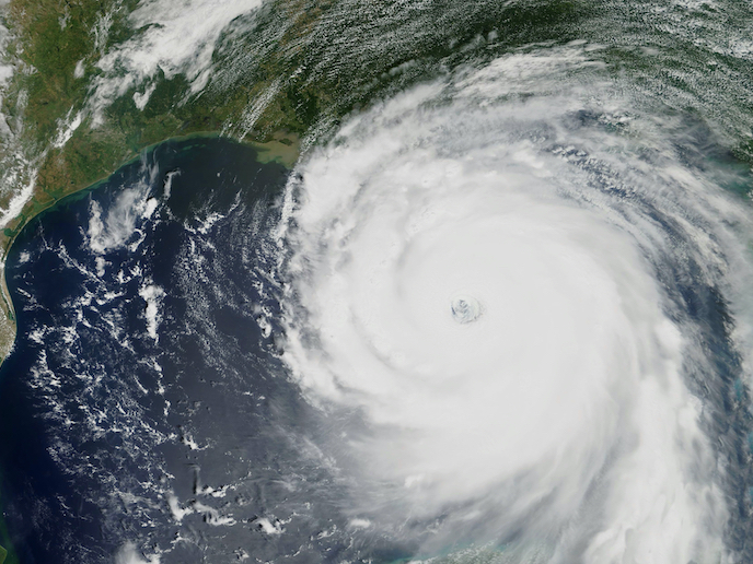
A key trend in the Earth Observation (EO) market is the move towards intelligent and autonomous satellites, offering products and services with increased responsiveness, availability, consistency and crucially, low latency. Latency refers to the time lag between an observation being captured and its delivery to the end user. That observation could be an image or higher-level information, such as data indicating severe storms forming over particular locations. “Basically, end users will be able to see what they want, when they want, close to real time, enabling them to quickly extract critical information efficiently and at low cost,” says Murray Kerr, EO-ALERT project coordinator from Elecnor Deimos, the project host. Given how important speed of information is to the effectiveness of emergency response, the EU-supported EO-ALERT project developed a proof of concept for real-time global EO services.
Proof of concept architecture
EO-ALERT began by defining use-scenario characteristics, such as emergency situations, requiring real-time information. This enabled the team to design their new EO architecture using edge computing. “This step was key for our multidisciplinary team, as an architecture for real-time EO civil services did not previously exist,” explains Kerr. The team then assembled the technological building blocks comprising three key elements: the sensor (an optical camera or synthetic-aperture radar (SAR) sensor), the on-board computer for processing sensor data on the fly, and a global communications system to deliver the information to end users. “Our final system is actually functionally similar to current mobile phones. The key difference it that the satellite and imager fly around the Earth at approximately 7 kilometres per second, taking images at a distance of 600 km,” adds Kerr. Testing the system covered scenarios such as extreme weather nowcasting and working with CMRE in La Spezia, Italy, for real-time maritime vessel detection and classification – important for search and rescue missions. With the full EO-ALERT system not yet operational, the images came from two European satellites, an optical satellite, DEIMOS-2, and an SAR satellite, TerraSAR-X. Their raw data was processed on the ground before global transmission using a GEO-relay communication system. “We were surprised how well the system performed in the final testing. The goal had been to achieve latencies under 5 minutes, faster than operational systems at the time.” “We actually achieved vessel detection and classification in about 1 minute, communicated globally also within 1 minute – practically real time for satellite imaging,” says Kerr.
Mission possible
EO-ALERT has shown that small, low-cost intelligent satellites using optical sensing (cameras with visible and infrared bands) and radar sensors (like the SAR sensor) can be developed to provide real-time EO services. “This matters because disaster management teams require different types of information, and so different sensors,” remarks Kerr. European organisations themselves have been stressing the need for more accurate and faster satellite data for better decision-making, recently highlighted by the 2022 Space Summit which made timely disaster management a key focus area, especially in relation to climate change. EO-ALERT’s architecture and software is currently being used by project partners such as DEIMOS for its Sat4EO satellite, and is also commercially available for testing and employment in missions, through products such as Insight4EO. The next step will be to demonstrate EO-ALERT’s solution operationally in orbit, through an IOD/IOV mission, and to deploy these capabilities in upcoming European and commercial missions. “We would love to see EO-ALERT soon contributing to emergency services, especially within future Copernicus systems,” concludes Kerr.
Keywords
EO-ALERT, Earth Observation, satellite, disaster management, emergency response, edge computing, search and rescue, Copernicus, sensors


