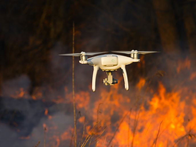
New technology for drone-based emergency response missions
In 2017, the world saw 335 natural disasters, affecting over 95.6 million people and resulting in 9 697 deaths and nearly EUR 300 billion in damages. 2017 also saw many emergency first responders leverage the power of drones to quickly locate victims and get them the support they needed. From earthquakes to forest fires, hurricanes to floods, drones are revolutionising disaster response efforts and helping to save lives. But this is just the tip of the iceberg. To truly benefit from the full potential of drones, their use needs to be backed by an efficient, structured operating system. This needs to be capable of processing data in real time and providing objective information for critical decision-making. Enter the project DRONECOP (The first integral control and command system for managing missions which delivers 3D cartography and georeferenced data in real-time), which focused on drone-based emergency response missions. “DRONECOP gives natural disaster management bodies the critical information they need to plan their missions and make fast, effective decisions,” says Luis Izquierdo, a researcher at Geointelligence Systems, a Spanish geopositioning company and creator of the DRONECOP system. “This will ultimately result in a drastic decrease in fatalities and injuries – among both civilians and rescue crews – and reduce a disaster’s social, environmental and economic impact.”
Accurate 3D mapping information
Developed with the support of EU funding, DRONECOP provides accurate and updated 3D mapping information and georeferenced targets. The system includes a very accurate, real-time kinematic (RTK) positioning system, which is installed onto the drone. It also contains a robust digital communication channel and a high-performance, ground-control system. This is capable of processing imagery in near real time. During the project, Geointelligence also conducted an in-depth feasibility study. “We defined the specific requirements and configurations for three different use applications: forest fires, floods and earthquakes,” explains Izquierdo. “We also analysed the technical viability of integrating firefighting systems, such as fire-extinguishing capsules, directly into the drone.”
Ready to disrupt
Confident that the DRONECOP solution was technically feasible, researchers next analysed whether it was economically viable. This included a comprehensive review of the manufacturing process and costs. According to Izquierdo, what the team found was that not only does the system provide outstanding accuracy (< 2 cm at 80 km/h), it does so at a very attractive price point (up to two thirds the cost of competing solutions). In other words, DRONECOP is well positioned to tap into the estimated EUR 10.5 million aerial disaster relief services market. “DRONECOP will disrupt mapping for the incidents and emergencies market, carving out a new niche of integrated management systems with real-time 3D mapping and georeferenced data,” adds Izquierdo. “More importantly, it will make disaster management operations safer, faster and more efficient than ever.” Geointelligence is currently working to secure financing to bring DRONECOP to market. They are also in conversation with such international government bodies as the United Nations.
Keywords
DRONECOP, drones, natural disasters, emergency first responders, geopositioning, mapping, emergency response, disaster response


