Digital rail network mapping achieves efficiencies
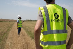
The EU-funded Skylynx (Upgrading Railways from the Air) project has underlined the benefits of digitalising Europe’s rail network. By more cost-effectively targeting the maintenance of assets along the line, the need to put workers in harm’s way is reduced, allowing operators to allocate staff to more valuable tasks. The deployment of assets can also be more efficiently planned. “Rail operators have in the past visualised the rail corridor using paper and technical drawings,” explains project coordinator Jorge Lopez-Sanchez from SigmaRail in Spain. “What we propose instead is something like a Google Maps app for railways. Pictures are taken by drone, with 3D ‘street views’ achieved through 3D cameras. Our Sigma-Q technology also tags assets and relevant information that will be useful for the design, operation and maintenance of tracks.” Europe’s secret success A key aim of the project has been to facilitate the efficient deployment of the European Railway Traffic Management System (ERTMS), a relatively unheralded European success story, according to Lopez-Sanchez. “Before ERTMS, each European country had its own signalling system,” he explains. “This meant that if you wanted to send a train from London to Amsterdam for example, you either had to change trains or equip trains with multiple signalling equipment, which is expensive or slow. This is how the idea to create one single system across Europe came about.” ERTMS is now Europe’s de facto standard signalling system, and for new lines being constructed in Europe, there is no alternative. ERTMS has also become a global success, and is being deployed in countries including Saudi Arabia, Australia and Mexico. The deployment of ERTMS however remains a challenge. Europe’s legacy of multiple automatic train protection systems has slowed progress and required huge political effort in order to agree on a system that is suitable for all EU members. Lopez-Sanchez also points out the technical challenges in creating a system that is truly functional across all EU Member States, as well as deploying advanced systems along old rail lines. Digitalising rail networks Gathering data on the state of these lines is therefore crucial. “Deploying advanced signalling systems such as ERTMS requires operators to know the exact location of safety-related rail assets such as signals and danger points,” explains Lopez-Sanchez. “You can imagine that a system designed to carry thousands of people at a speed of up to 350 km/h requires a high degree of accuracy.” This was the starting point of the Skylynx project; applying cutting-edge technology to develop the digital models of rail corridors. “The benefits for industry are huge,” says Lopez-Sanchez. “Workers for example will not be required to gather data from the tracks, since this task can be accomplished using drones. This will significantly improve safety. Rail companies will be able to quickly identify lines in need of maintenance, saving time and money. At the end of the day, operational efficiencies will translate into lower costs for the general public.”
Keywords
SKYLYNX, SigmaRail, rail, drones, tracks, digital, technology, ERTMS, 3D


