Unleashing the potential of Earth observation data
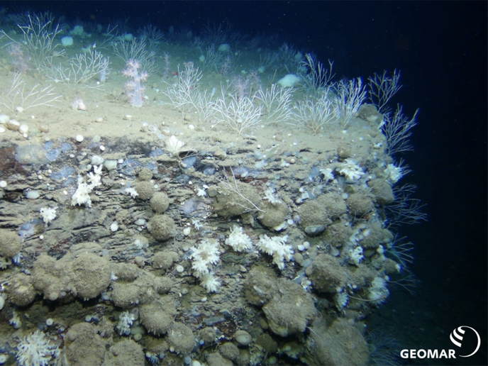
Earth observation (EO) data collection is increasing exponentially thanks to satellites, in situ sensors and more, including citizen scientists. These multi-source data are also in multiple data, temporal and spatial formats, making it increasingly difficult for even technical experts to analyse critical information quickly, effectively and economically. The EU-funded EO4EU project is targeting a one-stop-shop approach to facilitate the discovery and processing of EO data. Consolidating massive amounts of data from EO data providers, its machine learning models dynamically extract patterns and insights that are easily accessible to users via improved user interfaces and extended reality.
EO4EU data ecosystem
The EO4EU platform consolidates: historical data from open-access datasets; real-time data including from smart wearable devices, mobile applications and IoT sensors; and data and services from global and European cloud-based platforms. The last include Copernicus, Galileo/EGNOS, GEOSS (the Global Earth Observation System of Systems), DestinE (Destination Earth) and the European Centre for Medium-Range Weather Forecasts. Users can access raw EO data, execute a natural language query of the sources and inspect the available datasets by description. “EO4EU allows users to access the precise information they need for their research, analysis and decision-making processes,” explains Efstathios Chadjiefthymiadis of the National and Kapodistrian University of Athens, project coordinator.
Machine learning and knowledge graphs support holistic EO data processing
Machine learning enables dynamic annotation and compression of tremendous amounts of EO data, significantly reducing the time and cost of manual annotation. Relying on the latest advances in unsupervised learning methods, the EO4EU platform can extract useful information even from large, unlabelled datasets. These representations feed into downstream tasks for the learning of task-specific models. EO4EU uses knowledge graphs to integrate heterogeneous and distributed EO data sources, reducing the need for complex data processing and shortening the development time for new EO applications. With the fusion engine, the user will be able to combine datasets from different spatiotemporal snapshots. “The generic nature of the platform would not be feasible without the data abstraction and uniform treatment made possible with knowledge graphs. By linking diverse datasets, theories, and models, knowledge graphs facilitate cross-domain analysis and a holistic understanding of the Earth system and its interconnected processes,” explains Chadjiefthymiadis.
Augmented/extended reality and use
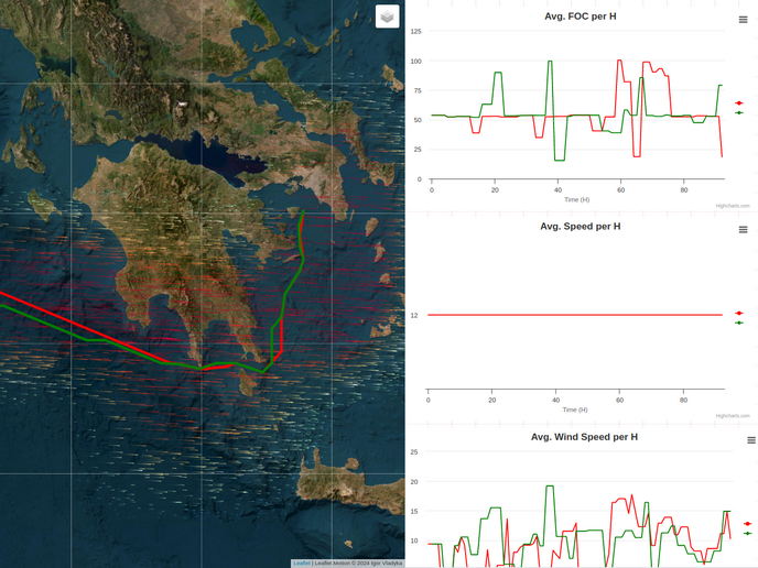
EO4EU has an easy-to-use interface including personalised dashboards, a smart search engine and data visualisation, analysis and interpretation. Users can also write their own code and execute it serverless with minimum effort. Finally, EO4EU provides an immersive experience with its augmented and extended reality interface. All this is freely available through a simple registration process. The platform was tested in seven use cases. For example, the ocean monitoring use case leverages an extract-transform-load (ETL) data integration pipeline that continuously harvests weather data and integrates it with operational data from vessels to optimise fuel consumption and routing. “This ETL pipeline helps train models that accurately predict fuel consumption. These predictions are utilised in real time to suggest alternative, environmentally friendly routes, ensuring compliance with regulatory standards. Additionally, we developed a convolutional neural network to monitor ocean conditions and predict ambient weather phenomena in real time,” explains Chadjiefthymiadis. The EO4EU project has made an invaluable contribution to FAIRifying EO data with its one-stop shop that facilitates finding, accessing and reusing EO data and analyses. It will significantly contribute to advancing environmental knowledge at local and EU levels.
Keywords
EO4EU, knowledge graphs, Earth observation, extended reality, machine learning, AI, data fusion, openEO