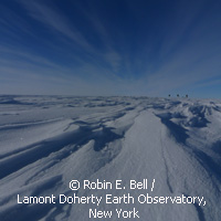
Getting to the bottom of Antarctica's refrozen ice
Fierce winds, sub-zero temperatures in the double digits, and a camp site in a remote beauty spot that is even harder to reach than the South Pole? Field research near Antarctica's Southern Pole of Inaccessibility, the point of the continent that is farthest from the oceans, is hardly for the faint of heart. But it has its rewards, such as the discovery that ice sheets don't build up from the top alone. Some of the growth appears to be added from below, by freezing water trapped under the continent's thick coat of ice. An international team of scientists has found that refrozen ice - deeply buried ice that has melted and subsequently reformed - makes up nearly a quarter of the ice sheet around Dome A, a plateau that forms the highest point of the East Antarctic ice sheet. In some places of this area, which is roughly equal in size to the continental US, more than half of the ice appears to stem from below rather than from the top. In these particular spots, the rate at which water refreezes exceeds that of surface accumulation. This discovery was made in the wider context of an International Polar Year project dedicated to Antarctica's Gamburtsev Mountains, a hidden range which is permanently covered by up to two miles (3.2 kilometres) of ice. On-site research carried out from November 2008 to January 2009 focused on a part of Dome A that is as large as the US state of California. Surveying the area in a gridline pattern from their aircraft, the scientists produced three-dimensional images of the landscapes under the ice with the help of ice-penetrating radars, laser ranging systems, gravity meters and magnetometers. The team's objective was to understand how the mountains arose, and to analyse the connections between the peaks, the ice sheet and the subglacial lakes of liquid water that the project had discovered earlier. Why would deeply buried ice begin to melt, and why would it subsequently refreeze? The team mentions two possibilities: heat could be generated by friction, or radiate from the underlying rock. Refreezing could then occur for a range of reasons. Where the ice is thin, freezing surface temperatures may penetrate the encasing layers. And where supercooled water, which remains liquid at lower depths due to the high pressure, is squeezed up valley walls into areas where the pressure drops, it can freeze very quickly. Ice sheets were known to grow as successive layers of snow fall and accumulate. 'We usually think of ice sheets like cakes - one layer at a time added from the top. This is like someone injected a layer of frosting at the bottom - a really thick layer,' says project co-leader Robin Bell, a geophysicist at the Lamont-Doherty Earth Observatory of Columbia University (US). 'Water has always been known to be important to ice sheet dynamics, but mostly as a lubricant,' Dr Bell adds. 'As ice sheets change, we want to predict how they will change. Our results show that models must include water beneath.' Refreezing does not just add volume; it also remodels the ice sheet, bending it upwards. 'When we first saw these structures in the field, we thought they looked like beehives and were worried they were an error in the data,' says Dr Bell. 'As they were seen on many lines, it became clear that they were real. We did not think that water moving through ancient river valleys beneath more than one mile [1.6 km] of ice would change the basic structure of the ice sheet.' Understanding the hidden depths of ice formation would help predict how ice sheets are likely to move, for example in response to changes in climate. This is also relevant with regard to the potential implications for sea levels. The findings also tie in with another one of the expedition's objectives: scouting for locations where coring could provide glimpses of a particularly distant past. 'Understanding these interactions is critical for the search for the oldest ice and also to better comprehend subglacial environments and ice sheet dynamics,' says Dr Fausto Ferraccioli from the British Antarctic Survey, who also helped lead the project. These observations were presented in the journal Science by team members from the British Antarctic Survey and the German Federal Institute for Geosciences and Natural Resources as well as four institutes in the US: Columbia University, Kansas University, the NASA Goddard Space Flight Center and the University of Maryland.For more information, visit:Earth Institute at Columbia University:http://www.earth.columbia.edu/sections/view/9To visit the websites of Antarctica's Gamburtsev Province Project, click: here and click: http://www.antarctica.ac.uk/press/featured/AGAP/hidden_world.php (here)To view the abstract in Science, click:http://www.sciencemag.org/content/early/2011/03/02/science.1200109.abstract (here)
Countries
Germany, United Kingdom, United States


