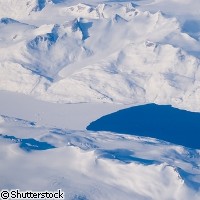
Getting to grips with Greenland's ice loss
Ice loss in Greenland is causing global sea levels to rise by half a millimetre a year, according to new research by Dutch and American scientists. While this doesn't sound like much, the researchers warn that the rate of ice loss appears to be increasing sharply, and in 2007 large amounts of ice were lost from high altitudes (above 2,000 metres) for the first time. The findings are published in the journal Geophysical Research Letters. The scientists from Delft University of Technology in the Netherlands and the University of Texas at Austin, US, arrived at their conclusions after analysing satellite gravity data taken between February 2003 and January 2008 by the German-American GRACE (Gravity Recovery and Climate Experiment) satellites. The data revealed that between 2003 and 2008, Greenland lost an average of 195 cubic kilometres of ice annually, enough to cause global sea levels to rise by half a millimetre per year. At this rate, Greenland would contribute 5 centimetres to global sea-level rise by the end of the century. However, this average figure masks a trend of increasing ice loss over time. In the first two years of the study, annual ice loss amounted to just 131 cubic kilometres. During the last two years, the rate of ice loss increased to 222 cubic kilometres per year. Much of this ice was lost during the extremely warm summer of 2007, when over 350 cubic kilometres of ice melted away in just two months. The data also enabled the scientists to study what was going on at the regional level. Their investigations revealed that the ice loss is greatest in the south-eastern and north-western corners of the country. In addition to this, more and more ice loss is being seen in northern Greenland and also at higher altitudes (over 2,000 metres). The amount of ice lost in the summer varies a lot from year to year, so further observations are needed to see if the ice will continue to melt at this rate and to calculate Greenland's contribution to global rise in sea level over the coming century. The researchers are now planning a follow-up study focussing on the influence on sea levels of the smaller glaciers in the region. Rising sea levels do not only play havoc on the planet's environment, their effect can also be seen in changes in the Earth's gravity. The Earth's gravity is not the same the world over, but varies in response to features such as mountain ranges, valleys and oceanic trenches. In areas with a higher mass, such as mountain ranges, the gravitational field is stronger. In contrast, it is lower around deep oceanic trenches. Sometimes the gravitational field of a location changes over time, for example as sea levels rise or ice caps melt. The GRACE satellites used by the researchers for this study are able to detect minute changes in the Earth's gravity. Launched in March 2002, the satellites are run jointly by NASA and the German Aerospace Centre (DLR). The two satellites circle Earth 220 km apart, with the second satellite following the path of the first one. When the first satellite passes over a change in the Earth's gravitational field, it is pulled away from the second satellite. When the second satellite passes over the same spot, it is pulled back towards the lead satellite. An extremely precise ranging system on the satellites is able to measure these changes in the distance between the two satellites with pinpoint accuracy. Another device helps the GRACE team to rule out changes in distance caused by other factors such as atmospheric drag, and GPS (Global Positioning System) receivers give the exact location of the satellite over the Earth. With this information, the GRACE team is able to put together a high-resolution map of changes in the Earth's gravitational field.
Countries
Netherlands, United States


