

Satellite imaging technology for safer Arctic operations
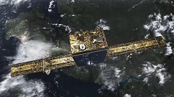
Precise and frequently updated ice data are important for shipping operations in the polar seas. Fast-moving vessels involved in such operations need to reduce the collision risk posed by the moving ice fields and icebergs. The security of mining operations, especially in the icy waters of the Baffin Bay area where there is round-the-clock ore shipping, is reliant on timely data. Iceberg monitoring and movement forecasting at frequent intervals should make mining and shipping operations safer. Based on a constellation of small satellites, ICEYE's imaging solution should provide day and night imaging regardless of cloud cover. SAR satellite imaging is exceptionally well suited for detecting and reacting to icebergs. “ICEYE’s imaging radar instrument will be able to see from space, through clouds and darkness – namely through all those atmospheric conditions that limit camera-based services in places where regular sunlight and fine weather is not an option,” notes ICEYE’s chief security officer, Pekka Laurila. A swarm of small satellites ICEYE has developed an unmatched SAR system in the world, which fits into a satellite less than 100 kg in launch mass. Tapping into the most recent developments in mobile technology, ICEYE’s radar sensors can be squeezed into a microsatellite platform that is 20 times lighter than its governmental cousins. ICEYE satellites are designed to operate in swarms, providing better system reliability while reducing the response time to just a few hours. “Current radar imaging solutions are limited to repeating observations of an area of interest only twice per day, let alone that systems need to be pre-programmed many days in advance,” notes Laurila. ICEYE will change that by launching a constellation of more than 18 small SAR satellites by 2020 that should bring frequent, high-resolution mosaicking of images to customers at affordable rates. "SAR on small satellites? Unthinkable a few years ago. ICEYE has done it," notes Josef Aschbacher, director of Earth Observation at the European Space Agency (ESA). Outperforming big satellites with better instruments ICEYE’s compact SAR instrument uses the latest technology and design philosophies in the world. Platform-agnostic by design, it can also be integrated into systems other than spacecraft. Welcoming the opportunities and limitations of commercially available off-the-shelf components, the overall design of the SAR instrument enables completely new capabilities. This ‘New Space’ approach allows ICEYE to overcome state-of-the-art technology in terms of quality, cost-effectiveness and timeliness and support the SAR instrument in the harsh environment of space. “The collaboration with ICEYE is helping us move distinct steps closer to our goals as we explore the potential in the ‘New Space’ industry,” said Aschbacher. Utilising off-the-shelf mobile electronics and mass manufacturing, ICEYE aspires to 100 times lower operational costs compared to traditional satellites. A multitude of applications ICEYE will launch its constellation of tiny satellites into low Earth orbit where there is less noise and radiation, and operations benefit from lower costs. ICEYE's first satellite, X1, launched aboard with other satellites has already taken 600 images during its first few months of operation. Besides monitoring changing sea ice for maritime uses, data received from the microsatellites can be used in a vast array of applications. “The need and opportunity for ICEYE’s satellites are enormous,” said Jyri Engestrom, member of the investment team at True Ventures. “From forest fires, to floods, search and rescue operations, and agricultural uses, ICEYE will be able to provide critical real-time information that today’s technology cannot.”
Keywords
ICEYE, synthetic-aperture radar (SAR), small satellite, constellation, Arctic waters, satellite imaging, microsatellite, low Earth orbit