Mars in high resolution and 3D
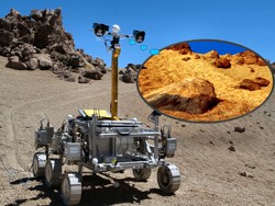
Over the last few years, international interest has grown in global exploration of the surface of Mars, more distant planets and planetary moons. In particular, a better understanding of the Martian surface morphology and geology can provide insights into the planet's origin as well as its capability to sustain long-term human presence. However, planetary images collected by past space missions and 3D data derived from stereo images focus on specific areas of interest. The EU-funded project PROVIDE (Planetary robotics vision data exploitation) was launched to exploit this wealth of imaging data by bringing them into a unified spatial and temporal context. PROVIDE partners gathered large portions of data returned from spacecraft put in orbit around planets and from probes that have landed on their surfaces. By means of a WebGIS and novel geospatial processing tools, they identified spatial relationships between imaging and other data and revealed hidden content to add new value for science. A multi-resolution visualisation software provides access to the final 3D vision products, allowing dynamic rendering of 3D scenes from planetary missions on Mars and the Moon, including access to the lunar archive panoramas received by Soviet Lunokhods. These digitised ground-level products help a 'virtual geologist' to perform close-ups on key features, like sedimentary layers. In addition, it is possible to measure distances and slopes to different levels of accuracy. Using a super-resolution restoration (SRR) technique, the project team revealed exciting photos of the Martian surface. These included ancient lakebeds and the Shaler rock outcrop or the Garden City site uncovered by NASA's Curiosity rover, NASA's MER-A rover tracks and Spirit's Home Plate rocks. They also released images of the 'lost' British landing spacecraft Beagle-2 that landed on Mars in December 2003 but failed to make contact with Earth. The SRR technique allows objects as small as 5 cm on the surface of Mars to be seen from orbit. Scientists employed the technique with stacks of between four and eight 25 cm images of the Martian surface taken with the NASA HiRISE camera to achieve the 5 cm target resolution. The innovative 3D vision and photogrammetry tools are expected to raise the scientific output of both past and future planetary missions. The project team employed them in the geological analysis of several Martian sites. Lessons learned during PROVIDE will lay the groundwork for 3D image-based mapping during the ExoMars mission of the European Space Agency (ESA) and ROSCOSMOS, scheduled to be launched in 2020.
Keywords
Mars, geology, surface morphology, robot vision, planetary images, super-resolution restoration


