One small step for robots, one giant leap for robot-kind?
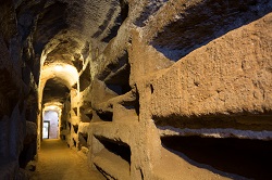
Digital technology is frequently used to record and map our cultural heritage, enabling research, preservation efforts and increased public access for sites of archaeological interest for example. Most contemporary techniques involve people entering such areas to capture them using a static 3D laser scanner. While this works for many sites, it does not work for all. The ROVINA project sought to address this limitation by using advances in autonomous robotic technology, which can get to hard or dangerous places to reach, such as tunnels or mines. The robots can navigate and explore, build textured 3D models (including a semantic interpretation) and return home on their own. ROVINA set out to build on advances in robotic digital mapping by improving accuracy, reliability and autonomy. Building a whole new robotic system To achieve the desired robust mapping, autonomous behaviour, realistic rendering, etc. the ROVINA team had to create a whole new robotic system. As Professor Cyrill Stachniss the project coordinator puts it, ‘Our techniques are at the forefront of robotics, computer vision and photogrammetry research.’ ROVINA faced a number of challenges. For example, as well as often arduous terrain, the scanning technology was faced with scene interpretation barriers, such as low lighting. Additionally, the situation was further complicated by constraints in communication with the robot which compromised the human tele-operation and supervision. To tackle these hurdles ROVINA drew upon the specialties of a diverse team with competency in the fields of digital preservation, autonomous and networked robots, 3D reconstruction and mapping, object detection and online learning, vision and perception, semantic analysis and user interface design. To integrate the various specialisms, the project proceeded using a modular software design, whereby each module which performed a specific task interacted through a middleware interface. Periodically, the modules were integrated and tested at different cultural heritage sites. The project developed a prototype that was able to explore the catacombs of Rome and Naples. The work fine-tuned intuitive and flexible user interfaces for remote robot interaction, despite the complex and unpredictable locations under exploration. Ease-of-use was an important project result as the likely end-users will vary - historians, archaeologists, construction engineers and even potentially virtual tourists. The prototype also demonstrated increased autonomy and reliability, with an ability to perform more accurate traversability analysis, resulting in improved navigation. The processing of the sensory data for navigation also also facilitated semantic information, such as the identification of interesting artifacts. Expanded capabilities ROVINA offers a powerful tool for cultural preservationists such as the International Council of Monuments and Sites. As Professor Stachniss explains, ‘With the ability of quickly acquiring digital models over time using the ROVINA system, combined with the tools for the analysis of temporal change in sites, it is possible to monitor levels of decay.’ Importantly, as ROVINA reduces the cost and time to make digital models, so the scope of area under investigation can be enlarged within a similar budget and time constraints. With the software able to adjust to sensors for scanning larger areas, autonomous (or semi-autonomous) digitisation becomes possible for GPS-denied environments, such as complex factories floors or indoor environments. In addition to the cultural heritage goals of the project, the work is also of interest to those working on autonomous robotics who are seeking to make their innovations more robust. To support this, key ROVINA development components have been released under a dual licensing model, as open source software available over the internet through the project website, as well as under a commercial license. Looking ahead to the future, Professor Stachniss summarises, ‘ROVINA's main target was geometric modelling firstly, with semantics only to some degree. We believe that the semantic aspect offers future potential and must be exploited. Secondly we need to simplify the robotic use and to target the automation of geodetic high-precision scanning, currently labour-intensive and so an expensive task.' For further information, please see: http://www.rovina-project.eu/
Countries
Germany


