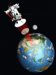
Satellites boost oceanographic research
The Gocino project has enhanced existing oceanographic research by promoting and exploiting data from the 'Gravity and ocean circulation experiment' (GOCE) satellite mission. GOCE is a new type of Earth observation satellite that can measure the planet's gravity field. The collection of accurate data enables sea surface height information to be fully exploited when used in the analysis and modelling of ocean circulation. This includes determining the mean dynamic topography (MDT). MDT is the difference between the mean sea surface and the hypothetical surface of the Earth that coincides with mean sea level, known as the 'geoid'. The MDT provides the reference surface for investigating ocean circulation and for satellite altimeter data. Information regarding mean sea surfaces was supplied by a number of institutes working with satellite altimetry. Data from the GOCE satellite was integrated by the Gocino project into four oceanography systems and a seasonal forecasting system. The dissemination of knowledge to national and regional operational centres was conducted in conferences organised by the consortium. The project's website was also used for dissemination of information, enabling knowledge and expertise to be developed throughout the consortium as well as being fully accessible to operational GOCE data users. Results from the Gocino project have helped to develop more accurate computer models, giving scientists a better understanding of the oceans. This information is particularly relevant at a time when the planet is subject to climate change and its affects on ocean circulation.


